地圖與地點
透過集合功能整理內容
你可以依據偏好儲存及分類內容。

允許使用者利用 Google 提供的豐富地圖探索世界。您可使用自訂標記來識別地點、使用圖片疊加層擴增地圖資料、以片段的形式嵌入一或多個地圖、顯示附近搜尋點的詳細資料等等。
Maps SDK
Maps SDK for Android 是 Google Play 服務平台的一部分,可讓您在應用程式中加入地圖和自訂地圖資訊。請按照「開始使用」指南在專案中設定 Google Play 服務,並深入瞭解 Maps SDK 的主要功能。
在應用程式中新增地圖
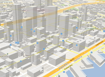
您可以透過 Maps SDK for Android,使用 XML 程式碼片段將地圖以片段的形式嵌入活動中。這個 SDK 提供許多令人期待的功能,例如 3D 地圖、室內、衛星、地形和混合地圖、用於有效率地快取和繪圖的向量圖塊,以及動畫轉場等等。瞭解如何新增地圖物件。
自訂地圖
在地圖上新增標記,為使用者指出特殊的搜尋點。您可以為地圖標記定義自訂顏色或圖示,以符合應用程式的外觀與風格。如要進一步改善應用程式,請繪製折線和多邊形來指出路徑或區域,或是提供完整的影像疊加層。詳情請參閱繪製標記指南。
控制使用者的檢視畫面
讓使用者控制地圖的「相機」視角的旋轉、傾斜、縮放和平移屬性。
瞭解如何變更檢視畫面。
在應用程式中新增街景服務
在活動中新增街景服務,讓使用者透過 360 度全景圖像探索世界。以程式輔助方式控制街景服務相機的縮放和方向 (傾斜和方位角度),並在指定期間內為相機動作加入動畫效果。
Places API
協助使用者根據目前的所在位置尋找商家、餐廳及其他搜尋點。使用 Places SDK for Android 在使用者需要時提供便利的相關資訊,例如聯絡資訊和營業時間。
這個頁面中的內容和程式碼範例均受《內容授權》中的授權所規範。Java 與 OpenJDK 是 Oracle 和/或其關係企業的商標或註冊商標。
上次更新時間:2025-07-27 (世界標準時間)。
[[["容易理解","easyToUnderstand","thumb-up"],["確實解決了我的問題","solvedMyProblem","thumb-up"],["其他","otherUp","thumb-up"]],[["缺少我需要的資訊","missingTheInformationINeed","thumb-down"],["過於複雜/步驟過多","tooComplicatedTooManySteps","thumb-down"],["過時","outOfDate","thumb-down"],["翻譯問題","translationIssue","thumb-down"],["示例/程式碼問題","samplesCodeIssue","thumb-down"],["其他","otherDown","thumb-down"]],["上次更新時間:2025-07-27 (世界標準時間)。"],[],[],null,["# Maps and places\n\nAllow your users to explore the world with rich maps provided by Google.\nIdentify locations with custom markers, augment the map data with image\noverlays, embed one or more maps as fragments, show details about nearby points\nof interest, and much more.\n\nMaps SDK\n--------\n\nThe [Maps SDK for Android](https://developers.google.com/maps/documentation/android-sdk/) is part of the Google Play services\nplatform and lets you include maps and customized mapping information in your\napp. Follow the [Get Started](https://developers.google.com/maps/documentation/android-sdk/start) guide to set up Google Play services\nin your project, then dive into the key features of the Maps SDK.\n\n#### Add a map to your app\n\nWith Maps SDK for Android, you can embed maps into an activity as a fragment\nusing an XML snippet. This SDK offers exciting features such as 3D maps;\nindoor, satellite, terrain, and hybrid maps; vector-based tiles for efficient\ncaching and drawing; animated transitions; and much more. Learn about how to\n[add a map object](https://developers.google.com/maps/documentation/android-sdk/map).\n\n#### Customize the map\n\nAdd markers onto the map to indicate special points of interest for your users.\nYou can define custom colors or icons for your map markers to match your app's\nlook and feel. To further enhance the app, draw polylines and polygons to\nindicate paths or regions, or provide complete image overlays. Learn more in the\nguide about how to [draw markers](https://developers.google.com/maps/documentation/android-sdk/marker).\n\n#### Control the user's view\n\nGive your users a different view of the world with the ability to control the\nrotation, tilt, zoom, and pan properties of the \"camera\" perspective of the map.\nLearn how to [change the view](https://developers.google.com/maps/documentation/android-sdk/views).\n\n#### Add Street View to your app\n\n[Add Street View](https://developers.google.com/maps/documentation/android-sdk/streetview) into an activity and let your users explore\nthe world through panoramic 360-degree views. Programmatically control the zoom\nand orientation (tilt and bearing) of the Street View camera, and animate the\ncamera movements over a given duration.\n\nPlaces API\n----------\n\nHelp your users find businesses, restaurants, and other points of interest based\non their current location. Use the [Places SDK for Android](https://developers.google.com/maps/documentation/places/android-sdk)\nto provide convenient, relevant information like contact information and\nbusiness hours when your users need it."]]